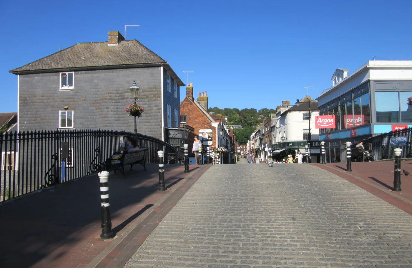

Seven actions from the Lewes floods report, led by only flood-adaptable building on a floodplain where 1,380+ homes are built or approved since 2000.
New homes on the Lewes floodplain should only be built if they are designed to flood safely, a report on the town’s flood risk says.
The Lewes Floods 25th Anniversary Report sets out seven priority actions. It draws on events held for the anniversary of the October 2000 floods. More than 1,200 people took part, the report says, and more than 170 answered a residents’ survey.
It was written by Juliet Oxborrow, co-director of Lewes Climate Hub, with a steering group of Love Our Ouse, Friends of Lewes and three Lewes town councillors. Environment Agency and East Sussex County Council flood staff reviewed it.
The report is dated September 2026. It was presented at Lewes Climate Hub on 10 October, according to the town council’s event listing.
The seven actions
The report recommends:
- Engage the town on community preparedness
- Only allow fully flood-adaptable development on the floodplain
- Launch a co-ordinated campaign to address surface-water flooding
- Put nature at the centre of flood strategy, and work out how much natural water storage is needed
- Lobby to make flood management a statutory duty for the incoming Sussex Mayor
- Build flood management into a wider climate change adaptation programme
- Make flood action collaborative, catchment-wide and multi-generational
It names three things to do first:
- bring back the Lewes Flood Action Group to run a town-wide preparedness programme
- launch a surface water flooding awareness and action campaign
- lobby the South Downs National Park Authority to allow only fully flood-adaptable new building on the floodplain
Where the risk is now
The report says flood walls built since 2000 have “substantially reduced” the risk in Cliffe, Malling and South Street.
But it says several places that flooded in 2000 have seen no new works. It names:
- the Pells
- much of North Street
- Eastgate Wharf
- the Railway Land
- Court Road
Environment Agency mapping shows the risk “remains high” in the town centre west of the Ouse, the report says. That includes the shopping precinct and the Eastgate Street and North Street area. It also says the risk of floodwater reaching the railway “remains high”, which could cut the town’s rail links north and south.
The river is part of the problem. Water from more than 1,000km of streams and rivers in the Ouse catchment has to pass through Cliffe Bridge, which the report calls a 16-metre-wide bottleneck.
The floodplain homes
Building on the floodplain was the single most repeated concern in the survey, and the most requested action.
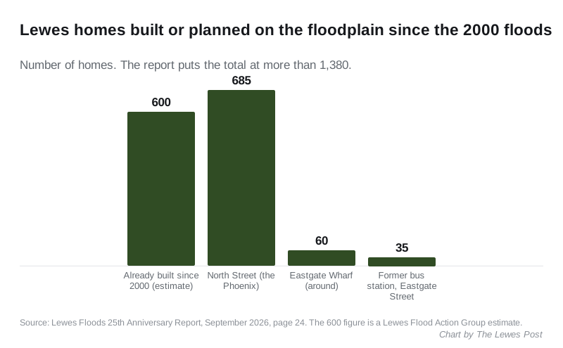
The report counts around 780 homes built or approved on floodplain land in the town:
- 685 on the old North Street industrial estate, known as the Phoenix
- around 60 at Eastgate Wharf
- 35 on the former bus station site in Eastgate Street
It adds those to an estimated 600 homes already built on the floodplain since 2000. That estimate comes from the Lewes Flood Action Group. Together, the report says, more than 1,380 homes have been built or approved there.
The report notes that flood mitigation is a condition of all these schemes. A further 226 homes are planned at Old Malling Farm, and the report says all of those are above the floodplain.
The planning policy that matters most here is the South Downs Local Plan, because Lewes is inside the national park. The report says it “doesn’t (yet) go as far as prohibiting building on the floodplain”.
What 2000 did to the town
The report sets out the scale of the October 2000 flood:
- more than 600 homes and 200 businesses flooded
- more than 1,000 people displaced
- the town cut in two for three days
- more than 100 properties flooded by sewage from inside as sewers backed up
- a clean-up that took over two years and cost £118 million, more than £250 million today
A severe flood warning was given at 11am on 12 October 2000. The Ouse burst its banks just over two and a half hours later.
The report says major floods have hit Lewes roughly every 30 to 40 years since records began.
Drains, Nevill Green and insurance
The survey found many residents reporting blocked drains, groundwater coming in, and low confidence in Southern Water.
The report asks for a “task and finish” group of Lewes District Council, East Sussex County Council and Southern Water. Its job would be to fix the continuing surface water and sewer flooding at Nevill Green.
Insurance was another worry. Several people asked what happens when Flood Re, the government-backed reinsurance scheme, ends in 2039.
What it means for you
Check your own address. The government’s long-term flood risk checker shows the risk from rivers, the sea and surface water. The report points out that surface water can flood homes well away from the river.
Newer residents especially. The report says many people now living in high-risk parts of town were not here in 2000, and may not know how serious it was.
You can respond. The authors ask for comments, and offers to get involved in flood action, by email to info@lewesclimatehub.org.
It is a recommendation, not policy. The report says its conclusions are the steering group’s, and do not necessarily reflect the views of all Lewes Town Council members. None of the seven actions has been adopted by a council yet.
Sources
- Lewes Floods 25th Anniversary Report (Lewes Climate Hub and partners, September 2026, PDF)
- Lewes Floods: report page (Lewes Climate Hub, read 14 October 2026)
- Talk: The Lewes Floods: 25th Anniversary Report (Lewes Town Council, event 10 October 2026)
- Check your long term flood risk (GOV.UK)
Have your say